EHRI Workshop on ‘Geography and Holocaust Research’ at ITS

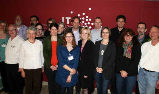
From 27th to 29th May 2013 the International Tracing Service (ITS) in Bad Arolsen hosted the EHRI workshop on “Geography and Holocaust research” with 18 participants from seven countries.
“We are very pleased to be the host for this important interdisciplinary exchange between academics. The findings of the geographers enable even better depiction of the geographical and time relationships of the Holocaust,” said Professor Rebecca Boehling, Director of the ITS.
The participants of the workshop presented various research projects which examined geographical aspects of the Holocaust for example ghettoization and deportation at certain sites, the routes of the death marches and the documentation of places of persecution. “We want to bring together the experts who are working on these subjects at various universities and other institutions. It gives us the opportunity to share our knowledge with one another and to consider cooperations,” said Alexander Avram, leader of the workshop and director of the Hall of Names in Yad Vashem.
With the aid of maps, the academics are able to retrace individual events and places of persecution and reconstruct the time plan of the Holocaust and the development of the concentration camps and ghettos. This information can also be linked with biographies, photos and eyewitness accounts. “This gives us detailed new possibilities for remembrance and educational work,” explained Avram.
The workshop was held as part of EHRI‘s Work Package on “Development of Interdisciplinary Methodologies”. The findings of the methodical exchange will also be incorporated in the development of the EHRI online portal and research environment planned for September 2014. This will offer an overview of archive materials on the Holocaust which are scattered throughout the world and enable improved access for researchers.
Photo: Three days of information exchange. Copyright: International Tracing Service (ITS) Bad Arolsen.
